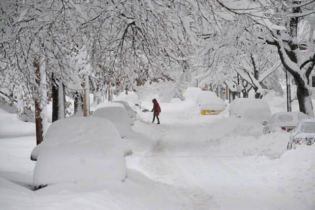
Throughout Pittsburgh’s modern history, major snowstorms have tested the city’s resilience. From the paralyzing “Big Snow” of 1950 to the more recent “Snowmageddon” of 2010, this kind of Pittsburgh weather has become defining moments for generations of Pittsburghers. While some brought record-breaking accumulations, others delivered brutal cold or caught the city completely unprepared.
This chronological journey explores devastating snowstorms that effectively shut down Pittsburgh over the past seven decades. Each event tells a story not just of snowfall totals, but of a city adapting, struggling, and sometimes even finding community despite being buried under mountains of snow.
The Big Snow of 1950
Thanksgiving weekend of 1950 marked the beginning of what would become Pittsburgh’s most devastating snowstorm on record.
The Big Snow of 1950 – Date & Duration
The massive winter storm, officially known as “The Great Appalachian Storm of 1950,” descended upon Pittsburgh late on November 24, 1950, continuing through November 30. The snowfall began in the early morning hours of November 24 and did not taper off until evening on November 25. Subsequently, additional snow fell daily through the end of the month.
The Big Snow of 1950 – Snowfall Totals
Pittsburgh recorded an astounding 30.2 inches of snow during this storm, though some sources cite the official total as 27.4 inches over three days. Regardless, this remains the single greatest snowstorm in Pittsburgh’s recorded history. The event launched what would become the city’s snowiest winter ever, with a total seasonal accumulation of 82 inches.
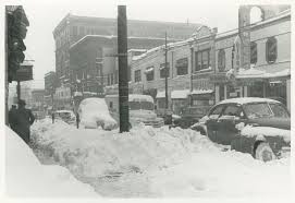
The Big Snow of 1950 – Citywide Impact
The heavy accumulation completely immobilized Pittsburgh. All traffic ground to a halt as streets became impassable. Mayor David L. Lawrence called up 200 members of the National Guard to assist. Furthermore, bulldozers and tanks were deployed to clear the massive snow piles. The city remained effectively closed to vehicular traffic for nearly a week, until December 1.
The Big Snow of 1950 – Notable Events
During the storm, temperatures plummeted to record lows, reaching single digits on November 25-26 3. Coal mines operated at limited capacity, with some miners becoming stranded. Expectant mothers were particularly vulnerable—doctors opened their homes for deliveries after ambulances could no longer navigate streets.
The Big Snow of 1950 – Historical Significance
At the time, this storm ranked as one of the costliest ever for insurance companies across the United States. The Great Appalachian Storm affected 22 states, claimed 160-383 lives (sources vary), and caused $66.7 million in damage. On NOAA’s Regional Snowfall Index, this powerful storm earned a Category 5 rating—the worst category—for the Ohio Valley region.
The Brutal Winter of 1976-77
The winter of 1976-77 stands out in Pittsburgh’s weather history as the coldest ever recorded, shocking residents after several years of milder conditions.
The Brutal Winter of 1976-77 – Date & Duration
Following a sequence of generally mild winters that began in 1971, this frigid season delivered unprecedented cold. Most notably, Pittsburgh experienced 33 consecutive days below freezing from December 26, 1976, to January 27, 1977. January 1977 was especially brutal, averaging just 11.4 degrees—the coldest month ever recorded in Pittsburgh and a staggering 17 degrees below the normal January average of 29 degrees.
The Brutal Winter of 1976-77 – Snowfall Totals
Throughout this punishing winter, Pittsburgh received 49.6 inches of total snowfall. Mountain areas surrounding the city accumulated well over 50 inches. The continuous snow cover began on November 29 and remained through late January, creating increasingly difficult conditions as the season progressed.
The Brutal Winter of 1976-77 – Citywide Impact
The extreme cold and substantial snowfall effectively paralyzed Pittsburgh’s infrastructure. Commerce ground to a halt as transportation became nearly impossible. Strong winds created enormous snow drifts that quickly closed freshly plowed roads. Additionally, all major rivers in Southwestern Pennsylvania remained frozen for weeks, further hampering fuel deliveries and economic activity.
The Brutal Winter of 1976-77 – Notable Events
The National Guard was mobilized to open roads and deliver essential fuel supplies. Dangerous power outages occurred throughout the region. Meanwhile, across the country, this historic cold snap even produced snow in Miami, Florida, and the Bahamas—the first such occurrence on record. The Polar Vortex was identified as the culprit, allowing Arctic air to settle across the region.
The Blizzard of 1993
Aptly nicknamed the “Storm of the Century,” the 1993 blizzard struck Pittsburgh with unprecedented ferocity, creating conditions that would serve as a measuring stick for all future snowstorms in the region.
The Blizzard of 1993 – Date & Duration
The massive weather system formed on March 12, 1993, when three independent weather patterns merged in the Gulf of Mexico . The first flakes began falling in Pittsburgh around 2:30 a.m. on Saturday, March 13. The storm continued through March 14, with some lingering effects into March 15.
The Blizzard of 1993 – Snowfall Totals
In Pittsburgh, the blizzard dumped a single-day record of 23.6 inches of snow, a record that still stands today. By evening, approximately 22 inches had accumulated, with more still falling. The storm ultimately deposited a total of 25.2 inches on the city.
The Blizzard of 1993 – Citywide Impact
The paralyzing storm closed roads throughout the region. Interstate highways from Atlanta northward were completely shut down. Schools remained closed until Tuesday, March 16. The extreme conditions forced road crews to work around the clock on cleanup duties.
The Blizzard of 1993 – Notable Events
Remarkably, Pittsburgh’s annual St. Patrick’s Day Parade proceeded as scheduled on March 13, even as the blizzard intensified. In fact, Pittsburgh was the only parade east of the Mississippi River that did not cancel. Parade Grand Marshal Glenn Cannon later noted this distinction with pride.
The Blizzard of 1993 – Historical Significance
The storm directly affected over 130 million people across 26 states. Throughout the eastern United States, it caused power outages for more than 10 million households. Ultimately, the blizzard resulted in 318 deaths and caused $5.50 billion in damages. Even “Snowmageddon” in 2010 hasn’t surpassed this historic storm in Pittsburgh’s collective memory.
The Cold Snap of 1994
January 1994 delivered Pittsburgh’s most frigid temperatures on record, establishing a benchmark for extreme cold that remains unbroken today.
The Cold Snap of 1994 – Date & Duration
This historic cold snap reached its peak on January 19, 1994, when Pittsburgh recorded its coldest temperature ever: -22°F. The high temperature that day only reached -3°F, matching the record for the coldest high temperature in Pittsburgh. Consequently, January 19, 1994 stands as the coldest day in Pittsburgh’s recorded history . Throughout this brutal period, temperatures remained below zero for an unprecedented 52 consecutive hours—the longest sub-zero stretch on record.
The Cold Snap of 1994 – Snowfall Totals
In contrast to previous major winter events, the 1994 cold snap was primarily characterized by extreme temperatures rather than heavy snowfall. Nevertheless, ice storms were prevalent in January-February 1994. The frigid air followed a heavy snowstorm in western regions and a wintry mix across other areas. Six Midwestern states experienced top-10 cold outbreaks measured over a four-day span.
The Cold Snap of 1994 – Citywide Impact
The severe conditions prompted then-Governor Bob Casey to declare a state emergency. He urged businesses to curtail operations and requested workers be sent home early. Power consumption reached unprecedented levels—6-8% above any previous peak. Utilities dimmed lights to reduce strain on the power grid, with some regions experiencing rolling blackouts to prevent complete grid failure. Although many schools closed throughout the Pittsburgh area, University of Pittsburgh students surprisingly still had classes.
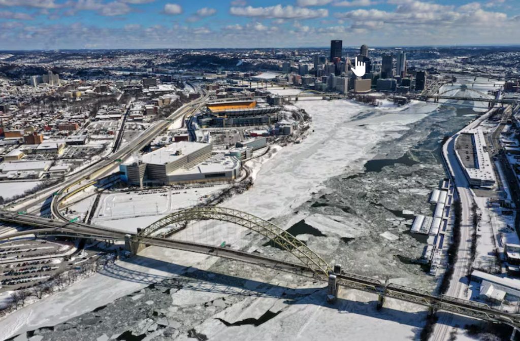
Snowmageddon 2010
February 2010 earned its place in Pittsburgh’s winter lore when a massive nor’easter dubbed “Snowmageddon” buried the city under nearly two feet of snow.
Snowmageddon 2010 – Date & Duration
The storm began on the evening of February 5, 2010, and continued throughout the following day. Within 24 hours, Pittsburgh experienced one of its largest single-day snowfalls on record. Even after the main storm passed, additional snow continued to fall throughout the month, contributing to February 2010 becoming Pittsburgh’s snowiest month ever recorded.
Snowmageddon 2010 – Snowfall Totals
The official measurement at Pittsburgh International Airport reached 21.1 inches, making Snowmageddon the fourth-largest snowstorm on record in Pittsburgh. This places it behind only the 1950 storm in terms of major snow events. Throughout the region, totals varied significantly, with areas in western Maryland and northern West Virginia receiving over 3 feet of accumulation.
Snowmageddon 2010 – Citywide Impact
Snowmageddon effectively paralyzed Pittsburgh and the surrounding areas. Most schools remained closed well into the following week as travel became virtually impossible. The weight of accumulated snow caused several roof collapses throughout the region. Moreover, the storm’s aftermath lingered as snowpacks ranging from 12 to 28 inches remained in place, with virtually none melting quickly.
Snowmageddon 2010 – Notable Events
Snowmageddon created a political controversy involving then-Mayor Luke Ravenstahl, who had traveled to Seven Springs to celebrate his 30th birthday. His absence during the emergency sparked criticism, especially after he was not seen publicly until several days after the storm. Elsewhere in the region, the storm’s intensity prompted rare responses, including Delaware’s governor ordering all vehicles off roads by 10 p.m. EST.
Polar Vortex 2014
The polar vortex that descended upon Pittsburgh in January 2014 brought Arctic-like conditions that made the city shiver with historically dangerous cold rather than struggle with massive snow accumulations.
Polar Vortex 2014 – Date & Duration
In early January 2014, a sudden stratospheric warming event led to the breakdown of the Arctic polar vortex. This breakdown allowed frigid Arctic air to plunge southward across much of North America between January 6-8. The coldest day struck on January 7, when Pittsburgh recorded a bone-chilling low temperature of -9°F, accompanied by a high temperature of just 4°F. The extreme cold persisted throughout much of January, as the polar vortex disruption continued to affect the region.
Polar Vortex 2014 – Snowfall Totals
Unlike other major winter events in Pittsburgh’s history, the 2014 polar vortex was primarily characterized by its extreme temperatures instead of heavy snowfall. Nevertheless, the leading edge of this Arctic air mass did bring substantial precipitation to some areas. In nearby regions, snowfall totals ranged from 5-7 inches. This weather pattern traveled from the American Plains and Canadian provinces to the East Coast, creating dangerous conditions even with moderate accumulations.
Polar Vortex 2014 – Citywide Impact
The bitter cold prompted meteorologists to warn Pittsburghers about near-instantaneous frostbite from exposure. As a result, newly-elected Mayor Bill Peduto moved his inauguration ceremony indoors. Power systems were severely stressed as demand surged to unprecedented levels. Throughout the PJM power grid region (which includes Pittsburgh), a new winter peak demand record was set on the evening of January 7. During peak demand hours, approximately 22% of generation capacity—including coal, gas, and nuclear—was out of service due to equipment failures. The extreme conditions nearly triggered emergency voltage reductions to prevent widespread outages.
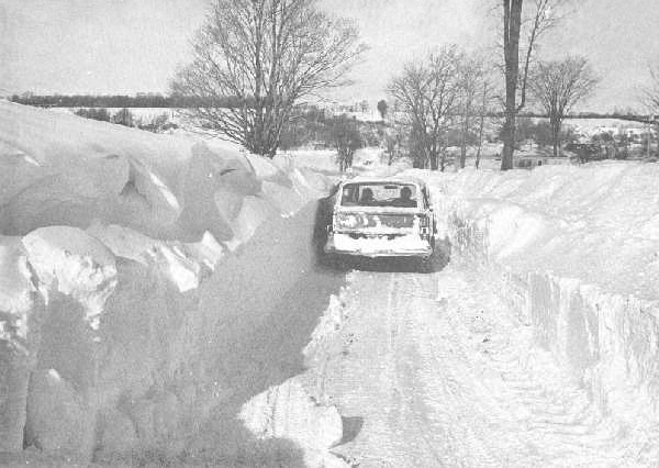
The Back-to-Back Storms of 1978
January 1978 hammered Pittsburgh with a relentless one-two punch of snowstorms that nearly crippled the city for weeks.
The Back-to-Back Storms of 1978 – Date & Duration
This winter onslaught began when the first storm blanketed Pittsburgh from January 16 through January 18. Before residents could properly dig out, a second storm immediately followed from January 19 through January 21. This brutal sequence created what would become the second-biggest back-to-back snowstorm event in Pittsburgh’s history.
The Back-to-Back Storms of 1978 – Snowfall Totals
The initial storm deposited 12.2 inches across the region. Soon after, the second storm dropped an additional 14.8 inches. Combined, these storms dumped 27 inches of snow upon the city. By month’s end, January 1978 had set a remarkable record with 40.2 inches of total snowfall. Equally impressive, the snow remained on the ground for sixty-four consecutive days, from January 8 through March 12.
The Back-to-Back Storms of 1978 – Citywide Impact
Essentially, Pittsburgh experienced total mayhem. Many businesses shut down operations before the weather worsened on Friday, January 20. Port Authority busses struggled to navigate snow-covered streets while being overwhelmed by riders avoiding driving. Schools closed for nearly a month owing to dangerous temperatures and fuel oil shortages. Some secondary streets remained unplowed for days as the city created enormous snow piles along major roadways.
The Surprise Storm of 1987
Unlike many winter storms that weather forecasters track days in advance, the Veterans Day storm of 1987 lived up to its nickname by delivering a genuine shock to Pittsburgh residents.
The Surprise Storm of 1987 – Date & Duration
The unexpected snowfall struck on November 11, 1987, catching meteorologists completely off guard. What made this weather event particularly jarring was the dramatic temperature swing – just two days earlier, Pittsburgh had enjoyed balmy 70-degree readings 11. Twin storm systems converged along the Eastern Seaboard, creating conditions that rapidly deteriorated throughout the day.
The Surprise Storm of 1987 – Snowfall Totals
Throughout western Pennsylvania, the accumulation varied significantly. Central Pennsylvania reported approximately 7 inches of snow, with certain areas receiving higher totals. The snowfall intensified rapidly, as forecasters repeatedly updated predictions throughout the day. Initially, meteorologists predicted just a few inches, yet continually revised estimates upward as the storm intensified.
The Surprise Storm of 1987 – Citywide Impact
The sudden snowfall created hazardous conditions across Pittsburgh’s hilly terrain. Power lines snapped under the weight of wet snow, leaving thousands without electricity. Schools closed abruptly, stranding many children for hours. Road conditions deteriorated swiftly, prompting numerous accidents. The storm’s unforeseen nature ultimately proved most dangerous – as one state trooper observed, “Thank goodness it was a holiday”, as fewer travelers ventured onto treacherous roads.
The Early Snowfall of October 1993
Halloween 1993 stands as a peculiar anomaly in Pittsburgh’s weather history when autumn festivities collided with winter conditions that typically arrive much later in the season.
The Early Snowfall of October 1993 – Date & Duration
On October 31, 1993, Pittsburgh experienced an unusual weather phenomenon—snow-covered ground for Halloween. This rare occurrence happened on a Sunday, making it even more remarkable for weekend trick-or-treaters. Historically, such early significant snowfalls are exceedingly uncommon in the region. According to weather records, the earliest trace of snow ever recorded in Pittsburgh occurred on September 23, 1989, while the earliest measurable accumulation (1.8 inches) fell on October 18, 1972.
The Early Snowfall of October 1993 – Snowfall Totals
Unfortunately, exact snowfall measurements for this specific event aren’t detailed in historical records. However, what makes this event notable is not necessarily its accumulation amount but rather its timing and persistence. The snow remained on the ground throughout Halloween day, creating an unusual backdrop for holiday activities.
The Early Snowfall of October 1993 – Citywide Impact
Beyond the visual oddity of snow-draped jack-o’-lanterns, this event made history as the coldest Halloween on record in Pittsburgh, with temperatures reaching only 35 degrees. This combination of snow cover and frigid temperatures undoubtedly affected trick-or-treating activities across the city. Historically speaking, this marks the only snow-covered Halloween in Pittsburgh within a 50-year period, highlighting just how extraordinary this meteorological event truly was.
The Christmas Snow of 2020
Christmas Day 2020 delivered a gift to Pittsburgh that residents hadn’t unwrapped in nearly a century – a record-breaking white Christmas that capped the second snowiest December in the city’s recorded history.
The Christmas Snow of 2020 – Date & Duration
The winter storm began on Christmas Eve with steady rainfall that transformed into snow as temperatures plummeted below freezing. By early morning on December 25, snow was falling steadily across the region. The snowfall continued throughout Christmas Day, with meteorologists predicting snow to fall “fairly steadily at least through lunchtime”. Prior to this winter wonderland, Pittsburgh’s last white Christmas had occurred in 2017, with a modest 1.4 inches of accumulation.
The Christmas Snow of 2020 – Snowfall Totals
The National Weather Service reported 3.9 inches of snow fell on Christmas Day alone, shattering the previous Christmas Day record of 3.5 inches set in 1909 and matched in 1935. Overall, the storm deposited 5.4 inches across the Pittsburgh area. This historic event propelled December 2020 to become the second snowiest December on record with a monthly total of 26.1 inches. Only December 1890, with 41.8 inches, recorded more snowfall.
The Christmas Snow of 2020 – Citywide Impact
The storm created treacherous travel conditions throughout western Pennsylvania. Road crews faced particularly challenging circumstances because the preceding rainfall prevented pre-treatment of surfaces. As temperatures rapidly dropped, roads developed extremely hazardous black ice. Pennsylvania’s governor advised residents not to travel unless “critical”, while the Department of Transportation reduced speed limits to 45 mph on numerous highways. The city deployed Department of Public Works crews to operate continuously from Christmas Eve through Friday evening, treating streets with blue-tinted magnesium chloride as temperatures continued falling.
The January 2024 Snowstorm
Mid-January 2024 brought another severe winter system that tested Pittsburgh’s snow preparedness, dumping nearly a foot of snow in some parts of the region.
The January 2024 Snowstorm – Date & Duration
The storm system developed across southeastern United States throughout the early morning hours of January 18, 2024, before tracking northeast along the Appalachian range. Snowfall intensified on January 19 as a post-frontal trough assisted in snow shower development, producing heavy precipitation at times. Indeed, the event continued into January 20, with some areas experiencing snow showers throughout Saturday. This created what meteorologists described as a “banded snowfall event” that delivered varying accumulation across the region.
The January 2024 Snowstorm – Snowfall Totals
Throughout Allegheny County, snowfall measurements ranged significantly. Unofficial observations revealed impressive totals: 10 inches in Fayetteville, 8.2 inches in Bethel Park, and 8.1 inches in Jefferson Hills. Parts of Washington County recorded up to 10.5 inches near Cecil. Most areas around Pittsburgh proper received between 2.5-4 inches. Originally, forecasters expected higher totals, yet the frontogenic banding proved weaker than anticipated. Ultimately, the lake-enhanced upslope snow quickly compensated for the initially lighter accumulation.
The January 2024 Snowstorm – Citywide Impact
Fortunately, municipal, county, and state road crews began preparations late Thursday night, making roads generally passable. The Pittsburgh Department of Public Works deployed approximately 50-55 trucks throughout the duration. Allegheny County positioned 22 salt trucks with plows on standby until midnight Friday, increasing to 32 trucks during heavier snowfall between 2 a.m. and 2 p.m. Wind gusts between 20-25 mph reduced visibility. Surprisingly, the county reported fewer accidents than typically expected during such conditions.
The Storm of 2026 – FERN
A massive winter storm Midwest residents are calling “unprecedented” slammed into Pittsburgh, bringing record-breaking snowfall and dangerous conditions throughout the region. The storm, currently classified as historic by meteorologists, has triggered emergency declarations across multiple states as temperatures plummet and snow accumulations reach critical levels.
Pittsburgh finds itself at the center of this weather crisis, with some areas reporting over two feet of snow in less than 24 hours. Meanwhile, surrounding states are battling severe ice accumulation, widespread power outages, and major transportation shutdowns. According to emergency officials, the combination of Arctic temperatures and heavy precipitation has created life-threatening conditions rarely seen in this part of the country. This comprehensive guide provides essential information about the storm’s development, impact, and what affected residents need to know to stay safe during this ongoing weather emergency.
How the Storm Formed and Traveled
The historic winter storm that battered Pittsburgh began its journey thousands of miles away, evolving through a complex series of atmospheric events before unleashing its full fury on the Midwest and Northeast.
Storm origins in the Pacific
This powerful winter system first developed as a cold-core low on January 22, forming over the Pacific Ocean. Initially tracking southeastward toward the Baja California peninsula, the system made landfall on Mexico’s Baja California peninsula late on January 23. Before reaching Mexico, Hurricane Hunters investigated the system to gather critical data about its moisture content, position, and projected track.
By midday January 23, the system had organized into a broad trough over the Great Plains and Rocky Mountains. As it moved inland, the storm began spreading wintry precipitation eastward, primarily in the form of sleet and freezing rain across northern Texas, southern Oklahoma, and southern Arkansas.
Interaction with polar vortex and Gulf moisture
The storm’s extraordinary strength stemmed from a rare convergence of atmospheric conditions. A wave in the upper atmosphere had elongated the polar vortex—a ribbon of high-altitude, fast-moving air that normally circles the Arctic region. This distortion allowed extremely cold Arctic air to spill southward into North America.
Several key factors contributed to the storm’s intensification:
- The stretched polar vortex created ideal conditions for the up-and-down movement of atmospheric waves, connecting the stratosphere with severe winter weather at the surface
- Multiple disturbances within the jet stream acted together to create favorable conditions for heavy precipitation
- The system pulled substantial moisture from the abnormally warm Gulf of Mexico
- The clash between cold northern air and high moisture from the south dramatically increased snowfall rates
By Saturday afternoon, the low-pressure system moved toward northern Missouri and Iowa, spreading intense snowfall across the region. The temperature contrast between the warm air over water and the cold Arctic air over land provided the fuel that powered the system’s continued growth.
Transition into a nor’easter
As the system approached the East Coast on January 25, it underwent what meteorologists call “Miller B type cyclogenesis”. Essentially, this means a new area of low pressure developed off the Southeast coast. This transformation turned the system into a classic nor’easter—a powerful winter storm that brings northeast winds along the Atlantic coastline.
The nor’easter strengthened as it moved northward, reaching its peak intensity near New England just south of Cape Cod early on January 26. This transformation occurred because of the sharp contrast between the warm Gulf Stream ocean current coming from the tropical Atlantic (typically near 70°F even in mid-winter) and the cold air masses moving down from Canada.
In the upper atmosphere, the strong winds of the jet stream rapidly removed and replaced rising air from the Atlantic, while the Coriolis force helped intensify the storm further. The counterclockwise winds around the low-pressure system blew moist air over land, where it collided with cold air from Canada at increasing speeds.
By January 26 at 21:00 UTC, as the system pulled away from the coastline and snow began to taper off, the Weather Prediction Center issued its final storm summary bulletin.
Snow and Ice Impact Across the Midwest
Winter Storm Fern left a trail of devastation across the Midwest, transforming the landscape into a treacherous winter wonderland with historic snowfall and debilitating ice accumulations.
Record-breaking snowfall in Pittsburgh
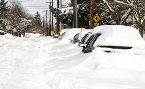
Pittsburgh found itself at the epicenter of this massive winter storm Midwest system, with snowfall that shattered previous records. On January 25, the city received a staggering 11.2 inches of snow, breaking the previous January 25 record of 5.2 inches set in 2014. This marked the most significant single-day snowfall in Pittsburgh since the infamous “Snowmageddon” of February 5, 2010.
The National Weather Service in Moon Township officially measured 10.7 inches at its office. However, areas north of Pittsburgh reported substantially higher accumulations, with some locations receiving up to 20 inches. Particularly hard-hit was New Bethlehem, which reported an astonishing 23 inches of accumulation.
Subsequently, Mayor Corey O’Connor declared a state of emergency for the city. The storm severely strained the city’s resources, with 37 of the initial 95 snow removal trucks being pulled from service due to mechanical failures amid the challenging conditions. As of early February, Pittsburgh has accumulated 36.5 inches of snow this winter, earning an “extreme” winter classification from climate centers.
Ice accumulation in surrounding states
Beyond the heavy snowfall, Winter Storm Fern brought dangerous ice conditions throughout the region. Several locations reported a full inch of accumulated ice from freezing rain, including parts of northwestern Alabama, northern Louisiana, northern Mississippi, and areas near Idabel, Oklahoma.
Furthermore, almost 80 other locations measured damaging ice accumulations of at least one-half inch 2. Some of the most significant ice measurements included:
- Byllesby, Virginia: 0.8 inches
- Clayton, Georgia and Hall Summit, Louisiana: 0.75 inches each
- Nashville metropolitan area: up to 0.75 inches
- Seneca, South Carolina: 0.75 inches
- Cedar Park, Texas (near Austin): 0.5 inches
The Little Rock, Arkansas metro area reported up to 8 inches of snow mixed with sleet, leading to hazardous road conditions with vehicles sliding off roads. Notably, ice damage extended as far south as Fredericksburg, Texas, in the Hill Country region, where downed tree limbs were observed.
Power outages and infrastructure damage
The combination of heavy snow and ice proved catastrophic for power infrastructure across the region. At its peak, over 1 million customers were without power on the afternoon of January 25. Tennessee experienced the most severe impact, with more than 308,000 outages reported as of Sunday afternoon.
Power outages spanned multiple states, including Mississippi (over 149,000), Louisiana (138,000+), Georgia (103,000+), Texas (80,000+), Kentucky (67,000+), West Virginia (33,000+), and South Carolina (28,000+). Particularly hard-hit was Davidson County, where Nashville is located, with power outages affecting an astounding 92% of the county.
Amid these challenges, more than 10,000 crews worked diligently to repair outages. Nevertheless, utility officials warned some communities could face outages lasting weeks as crews struggled to access damaged infrastructure. Ice proved to be the key threat to the electric grid, as even a quarter-inch accumulation can exponentially increase the weight on tree branches, raising the chances of limbs breaking and damaging power lines.
The frigid temperatures accompanying the storm further complicated recovery efforts, driving up electricity demand as heating appliances required more energy and ran longer, putting additional strain on an already compromised power grid.
States issuing emergency declarations
President Donald Trump approved federal emergency declarations for at least a dozen states as the storm intensified, providing crucial federal support to nearly 900 counties, parishes, and four Tribal Nations. By Saturday, January 25, emergency declarations were in place across Arkansas, Georgia, Indiana, Kentucky, Louisiana, Maryland, Mississippi, North Carolina, South Carolina, Tennessee, Virginia, and West Virginia. This presidential action allowed states to access federal expertise and resources to protect lives, property, and public health.
Pennsylvania Governor Josh Shapiro signed a disaster emergency declaration on Friday afternoon, joining more than a dozen other states in taking preemptive action 4. “This declaration gives PEMA the flexibility to pre-position resources, streamline coordination, and respond quickly if conditions deteriorate this weekend,” explained Randy Padfield, director of the Pennsylvania Emergency Management Agency.
Locally, Pittsburgh Mayor Corey O’Connor and Allegheny County Executive Sara Innamorato both declared states of emergency after the historic snowfall. These declarations enabled officials to bypass normal procedures and immediately deploy all available resources, including hiring private contractors to assist with snow removal operations.
National Guard and FEMA involvement
More than 5,300 National Guard members were activated across 15 states in response to Winter Storm Fern. Guard units from Alabama, Arkansas, Delaware, Indiana, Kentucky, Maryland, Missouri, North Carolina, Oklahoma, Pennsylvania, South Carolina, Tennessee, Texas, Virginia, and the District of Columbia provided critical support, with members in six additional states placed on alert.
The scale of deployment varied by state:
- Kentucky activated over 2,000 Guard members
- Delaware deployed more than 100 personnel statewide
- Georgia Governor Brian Kemp deployed 120 National Guard members to northeast Georgia, the hardest-hit area
Simultaneously, the Federal Emergency Management Agency pre-positioned commodities, staff, and search and rescue teams in numerous states. Under Homeland Security Secretary Kristi Noem’s direction, FEMA staff embedded in state emergency operations centers across the affected region. The Department of Homeland Security Executive team remained active in FEMA’s National Response Coordination Center throughout the storm, monitoring conditions and coordinating interagency support.
Travel bans and public advisories
Government officials issued strict travel warnings as conditions deteriorated. “We just ask that everyone would be smart – stay home if possible,” urged Secretary Noem. In Pennsylvania, officials implemented Tier 4 restrictions beginning midnight Saturday, barring all commercial vehicles, including busses, trailers, motorcycles, recreational vehicles, and motor homes from the entire interstate network.
Additionally, Georgia officials advised residents in northern regions to get off roads by sundown Saturday and prepare to stay put for at least 48 hours. New York City Mayor Zohran Mamdani echoed similar sentiments: “Please, if you can avoid it, do not drive, do not travel, do not do anything that can potentially place you or your loved ones in danger”.
Across Ohio, county sheriffs issued snow emergencies in rapid succession, with multiple counties reaching level 2 or level 3 status – the state’s highest designations for winter road conditions. In Montgomery County, officials declared a level 3 snow emergency, officially closing all roadways to non-emergency traffic and warning that drivers ignoring the order could face prosecution.
Transportation and Utility Disruptions
Transportation networks and power systems collapsed under the weight of Winter Storm Fern, creating unprecedented disruptions across multiple states. The storm’s far-reaching impact paralyzed air travel, rendered roadways impassable, and left communities in darkness as utility companies struggled to respond.
Flight cancelations and delays
Air travel faced historic disruptions as nearly 10,000 flights were canceled on Sunday alone, marking the largest single-day cancelation event since the COVID-19 pandemic. Over the weekend, more than 13,000 flights were canceled nationwide, with disruptions continuing into Monday when an additional 4,245 flights were canceled and 8,831 more delayed.
The impact extended well beyond the storm’s immediate path as major airline hubs like Dallas–Fort Worth International Airport reported more than 700 canceled departure. Indeed, Will Rogers International Airport in Oklahoma City shut down completely, canceling all Saturday flights and Sunday morning operations. By late Saturday, almost all departing flights scheduled from Ronald Reagan Washington National Airport on Sunday had already been preemptively canceled.
Road closures and traffic accidents
On roadways, conditions deteriorated rapidly with tragic consequences. In Butler County, Pennsylvania, a series of crashes involving at least 25 vehicles occurred on Interstate 79, resulting in one fatality and nine hospitalizations. The victim died after his vehicle lost traction and collided with another that had slowed due to the pileup.
Moreover, Pittsburgh’s snow removal capabilities were severely compromised when more than a third of the city’s plow trucks broke down. Mayor Corey O’Connor declared a state of emergency after 37 of the city’s 95 plows were sidelined in repair garages. Pittsburgh Regional Transit suspended its paratransit service on Sunday, warning passengers to expect delays even as crews worked around the clock clearing bus ways and stations.
Power grid strain and blackouts
Concurrently, the electric grid faced extreme pressure as freezing temperatures drove up demand. The PJM Interconnection—the largest U.S. regional grid operator—saw spot wholesale electricity prices soar above $3,000 per megawatt hour from normal levels under $200 5. PJM predicted an all-time high for winter electricity demand at 147.2 gigawatts.
In effect, power outages affected more than 1 million homes and businesses across eight states. Tennessee suffered the worst outages with over 308,000 customers losing power. Other severely affected states included Mississippi (149,000), Louisiana (138,000), Georgia (103,000), and Texas (80,000).
Grid operators implemented emergency measures, with the Midcontinent Independent System Operator (MISO) issuing an “all-hands-on-deck” action to avoid capacity shortfalls. Throughout New England, oil-fired generation—typically accounting for just 1% of the grid’s output—surged to 38% as the region conserved natural gas.
Casualties, Damage, and Long-Term Effects
The human cost of the winter storm Midwest system continues to mount as officials confirm dozens of deaths across multiple states.
Confirmed fatalities and injuries
At least 42 deaths have been reported across states afflicted with severe cold. In Pennsylvania, three people aged 60-84 died while shoveling snow. Tragically, three brothers under 10 years old perished after falling through ice on a Texas pond. Other fatalities included teenagers in fatal sledding accidents in Arkansas and Texas, individuals run over by snowplows in Massachusetts and Ohio, and eight people found dead outdoors in New York City.
Economic cost of the storm
The economic impact appears historic, with AccuWeather estimating $105-115 billion in total damage and economic losses. Though some experts question this figure as potentially inflated, climate economist Adam Smith confirms this will easily become America’s first billion-dollar weather disaster of 2026. For context, the 2021 Texas freeze—previously the costliest winter storm—caused approximately $26 billion in damage.
Ongoing recovery efforts
Recovery faces significant challenges as more than 112,000 customers remain without power across Tennessee, Mississippi, Louisiana, Florida and North Carolina. Additionally, blood supplies face critical shortages after 500+ blood drives were canceled, resulting in 20,000 uncollected donations. The Red Cross has mobilized over 2,200 trained personnel, opening 150+ shelters that provided more than 14,400 overnight stays.

Winter Storm Fern has undoubtedly marked itself as one of the most devastating weather events in recent memory. The massive system that began in the Pacific transformed into a powerful nor’easter, leaving unprecedented destruction across multiple states. Pittsburgh, sitting at the storm’s epicenter, experienced record-breaking snowfall of over 11 inches in a single day, while surrounding states battled dangerous ice accumulations exceeding an inch in some locations.
The consequences proved catastrophic. More than one million customers lost power during peak outages, with Tennessee bearing the brunt as 92% of Davidson County residents found themselves in darkness. Transportation networks collapsed under winter’s fury – approximately 13,000 flights canceled over the weekend, highways closed due to dangerous conditions, and multiple fatal accidents reported throughout the affected region.
Perhaps most sobering, at least 42 deaths have been attributed to this historic storm. Families continue grieving lost loved ones while communities face the daunting task of rebuilding. AccuWeather estimates place economic damages between $105-115 billion, potentially making this the costliest winter storm in American history.
Though emergency declarations activated crucial resources and thousands of National Guard members deployed to affected areas, recovery efforts face significant challenges ahead. Blood supplies remain critically low after hundreds of collection drives were canceled. Additionally, many areas still lack power days after the storm, and utility officials warn some communities might wait weeks for restoration.
As Pittsburgh and neighboring states work toward normalcy, this historic winter event serves as a stark reminder of nature’s awesome power. Though communities throughout the Midwest have demonstrated remarkable resilience, the road to full recovery will certainly extend well beyond the melting snow.
Throughout the decades, Pittsburgh has weathered some truly extraordinary winter events that tested the city’s resilience and adaptability. From the record-breaking 30.2 inches during “The Big Snow of 1950” to the bone-chilling -22°F temperatures of January 1994, these historic storms have shaped the Steel City’s winter identity. Each significant snowfall tells a story beyond mere meteorological data – they represent shared experiences that unite generations of Pittsburghers.
What stands out across all these devastating storms remains their ability to transform this bustling metropolis into a standstill. Schools close, businesses shut down, and transportation grinds to a halt as the city’s challenging topography amplifies winter’s impact. Additionally, these weather events often require extraordinary responses, such as National Guard deployments, emergency declarations, and round-the-clock efforts from city workers.
Pittsburgh’s snowstorms have certainly evolved over time. Earlier events like the 1950 blizzard caught the city relatively unprepared, while modern storms benefit from advanced forecasting and emergency management systems. Nevertheless, Mother Nature continues to surprise residents, as seen with the unexpected Veterans Day storm of 1987 and the record-breaking Christmas snowfall of 2020.
The upcoming 2026 storm prediction highlights how Pittsburgh now approaches major winter events – with proactive salt stockpiling, vehicle preparation, and emergency declarations. This preparedness reflects lessons learned from seven decades of significant snowstorms.
Though these thirteen devastating events temporarily paralyzed Pittsburgh, they also showcase the city’s remarkable ability to recover and adapt. Pittsburghers take pride in their winter resilience, evidenced by the famous 1993 St. Patrick’s Day parade that proceeded despite blizzard conditions. Undoubtedly, future generations will face their own historic snowstorms, adding new chapters to Pittsburgh’s storied relationship with winter’s most challenging moments.