The Fascinating History of the Mexican War Streets in Pittsburgh
The Mexican War Streets is a historic district located in the Central Northside neighborhood of Pittsburgh, Pennsylvania. This charming area is known for its beautifully restored row houses, community gardens, and tree-lined streets. But what is the history behind this unique district? Let’s take a journey back in time to discover the origins and development of the Mexican War Streets.
The Early Settlement and Development
The history of the Mexican War Streets can be traced back to the early Native Americans who used the area as a hunting ground. The land was a low-lying, central area just below a massive sandstone ridge formed south of the great glacier push. The first documented settlement in the area is attributed to James Robinson, who is considered the first settler of the Northside.
In 1783, the Pennsylvania General Assembly designated the wilderness north of Pittsburgh as a Reserve Tract for the development of a new town. Surveyed at 3,025 acres in 1785, the land was divided into town lots and outlots. The town was centered on the intersection of the Venango Trail and the Great Path, two Native American routes that left their imprint on the land.
The Development of Allegheny Town
David Redick was commissioned to prepare a plan for the Reserve Tract, and in 1788, he delivered the Plan of the Reserve Tract Opposite Pittsburg. The town was laid out based on early colonial models, with a town square, surrounded by common land, and outlying lots. Settlers were encouraged to own a town lot for residential purposes and an outlot for agriculture.
Prior to Redick’s plan, James Boggs had cleared a portion of land on the northern bank of the Allegheny River in the 1760s. However, Native American unrest forced him to retreat back to “Pittsburg.” In the early 1780s, he returned and cleared nine acres, but tragically died while felling trees. His widow, Martha Boggs, fought to retain her land claim, and the Council of the Commonwealth ruled in her favor.
In the 1790s, Martha Boggs married James Robinson, an adventurer and real estate developer. Robinson continued to acquire land, expanding the town of Allegheny. The town center and riverfront developed first, with some areas north of the commons cleared and converted to farmland. Robinson bought two outlots on the west side of the North Commons, along what was then called Shanopin Lane (now North Avenue).
The Rise of Mechanic’s Retreat and Expansion of Allegheny Town
Circa 1815, the upper part of the Reserve Tract, known as Mechanic’s Retreat, was subdivided and developed into a residential area for workers employed in early industries along the banks of the Ohio River. Mechanic’s Retreat was a rural enclave of modest housing surrounded by undeveloped land. However, there was no significant development north of the commons during this time.
By the 1820s, Allegheny Town’s population reached 1000, and it was incorporated as a borough in 1828. James Robinson acquired the last outlot in the lower tract, giving him ownership of all the land fronting the North Commons. The first expansion of Allegheny Town on the north side of the commons occurred in these outlots, specifically on the west side of Federal Street.
Existing streets south of the commons, such as Beaver Street (now Arch), Middle Alley (now Reddour), and Webster Street (now Sherman), were extended north to the other side of the commons. Benton Alley (now Eloise) was also established during this period. However, there was still no development east of Federal or west of Brighton, and James Robinson’s outlots opposite the commons were primarily used for agriculture.
The Birth of Buena Vista and the Mexican War Streets
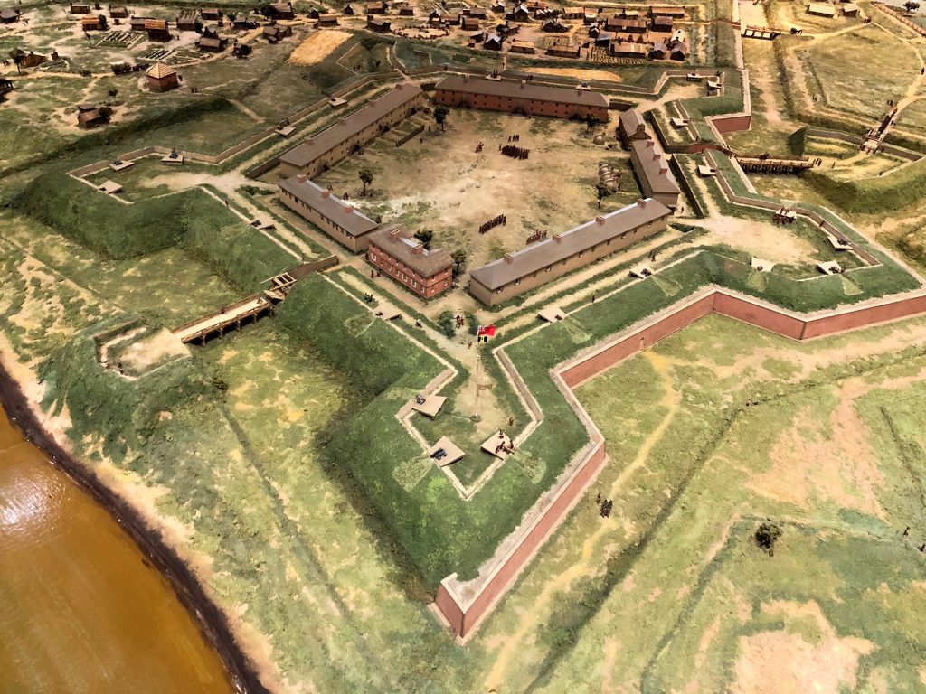
During the 1840s, Allegheny Borough became Allegheny City, and the town experienced expansion on all sides. James Robinson’s son, General William Robinson, developed the outlots at the west end of North Avenue, opposite the commons. This development was named Buena Vista, and the streets were named after places and people from the Mexican-American War, giving rise to the later name, Mexican War Streets.
The original Buena Vista development was bounded by Taylor Street on the north and Palo Alto on the east. The area between Palo Alto and Webster (Sherman) was left undeveloped. As the years passed, the Mechanics Retreat area was substantially rearranged, with the extension of Buena Vista and Monterey Streets from Robinson’s development. These streets were extended north to Carroll Street (Armandale), which was renamed Ackley Street.
Residential development expanded west from Federal Street to meet the newly extended Monterey Street. Lower Buena Vista, although initially dominated by stockyards, saw increased residential development. The extension of Buena Vista brought many more built-out lots on upper Buena Vista, while lower Buena Vista still had available lots. Freemont Street (now Brighton Place) also experienced housing development due to the trolley line.
The Growth and Gentrification of the Mexican War Streets
By the 1880s, the population of Allegheny City had surpassed 75,000. The installation of sewer and water service throughout the lower wards was a major development in this decade. Buena Vista was extended north to meet Perrysville Avenue, crossing O’Hern Street in the process. This expansion improved accessibility to the observatory and the Western University of Pennsylvania, which overlooked the town.
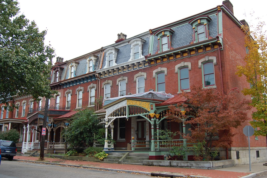
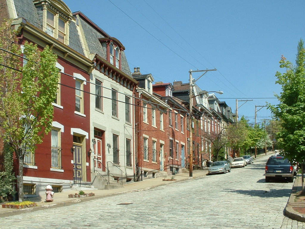
The build-out of housing in the Mexican War Streets in the 1890s reflected the rapid population growth and a period of gentrification. The original modest structures built in the 1820s to 1850s were remodeled, expanded, or replaced by more affluent middle-class homeowners. The district saw the construction of spacious homes, incorporating various Victorian architectural styles such as Italianate, Gothic Revival, Richardson Romanesque, Empire, and Queen Anne.
With the exception of the grand homes on North Avenue, the Mexican War Streets were never as opulent as Millionaires Row on Ridge Avenue. However, the district’s buildings boasted style and quality craftsmanship. The use of local materials like stone from nearby quarries, lumber from the Allegheny Forest, and glass made in Pittsburgh showcased the city’s emergence as a first-tier industrial center and the growth of the middle class.

The Enduring Legacy
Today, the Mexican War Streets Historic District stands as a testament to the rich history and architectural significance of Pittsburgh’s Central Northside. The meticulously restored row houses, community gardens, and tree-lined streets transport visitors back in time to the era of the Mexican–American War.
As you explore the district’s streets, you’ll encounter names that pay homage to the battles and generals of that war, such as Buena Vista Street, Monterey Street, Palo Alto Street, and Sherman Avenue. The district’s designation on the National Register of Historic Places ensures the preservation of its unique character, with all exterior alterations subject to review and approval by the City of Pittsburgh’s Historic Review Commission.
Whether you’re a history enthusiast, architecture lover, or simply seeking a charming neighborhood to explore, the Mexican War Streets in Pittsburgh offers a captivating journey through time. Immerse yourself in the stories of the past as you wander among the beautifully restored homes and experience the enduring legacy of this historic district.