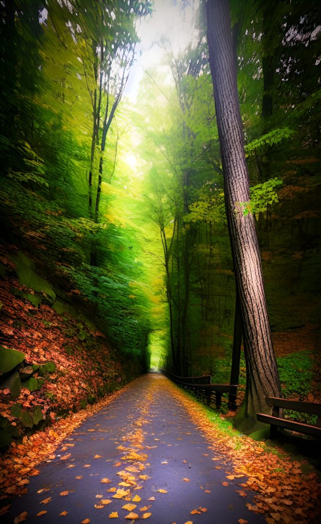
There is a network of great hiking and biking trails weaving it’s way through western Pennsylvania around Pittsburgh, many of them built on the foundations of old railway lines – a potent symbol of the area’s shift away from its industrial roots and towards a more socially conscious and healthy lifestyle. Every one of these paths has been carefully crafted and maintained, using existing infrastructure to link surrounding communities. Whether you want to hike into downtown Pittsburgh or take a long bike ride around the area, these “greenway systems” are representations of Pittsburgh’s progress.
If you’re looking for a way to get some fresh air and explore outdoor Pittsburgh and western Pennsylvania, here are some of the great biking or hiking trails in Pittsburgh and the surrounding area.
Three Rivers Heritage Trail
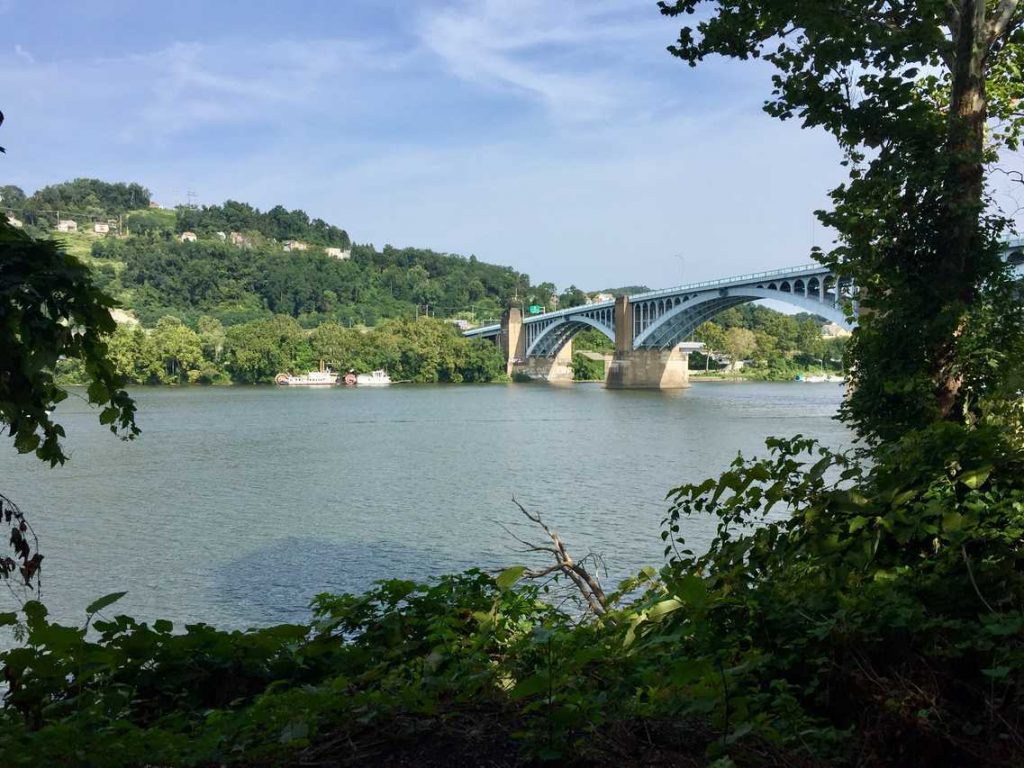
The Three Rivers Heritage Trail, a network of river paths that have been recuperated and restored by Friends of the Riverfront over a period of more than 20 years, links many of the key districts of Pittsburgh. This allows individuals to move easily around the city and access its three rivers. You could easily spend a few days exploring the 25 miles of interconnected pathways of the Heritage Trail (and more are in the pipeline). Then, the trails branch off from Allegheny County and stretch out in multiple directions into other areas of the state and beyond.
Distance and Location of the Three Rivers Heritage Trail: 25 miles along the Monongahela, Allegheny and Ohio Rivers
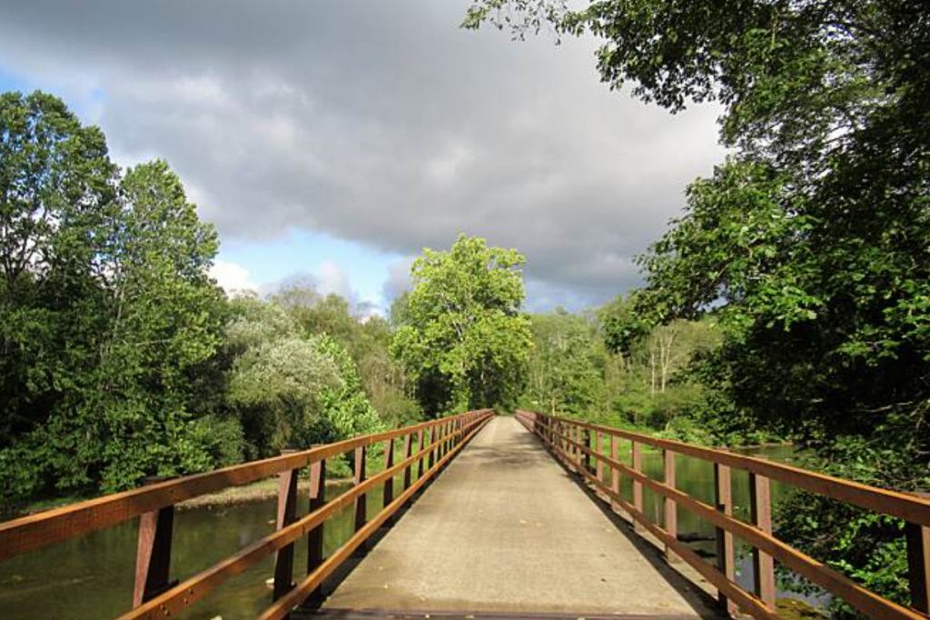
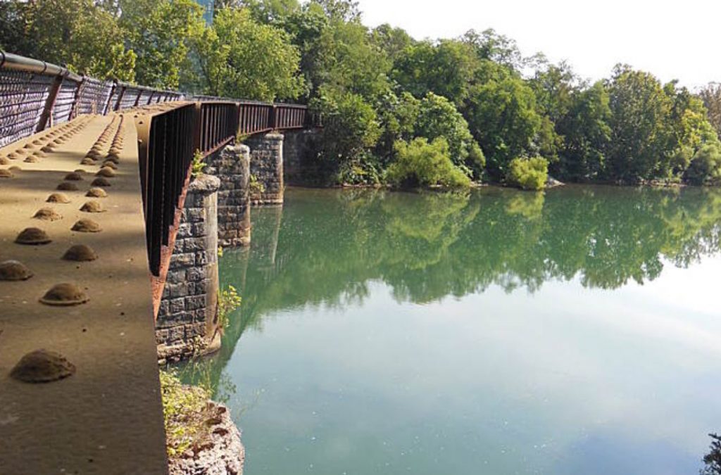
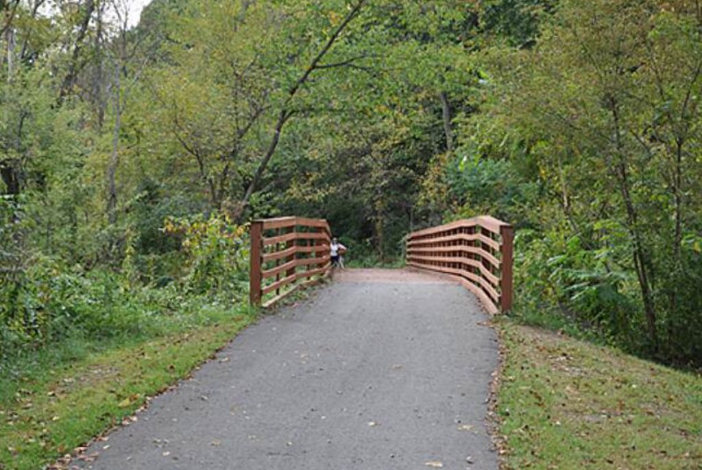
North Shore Trail
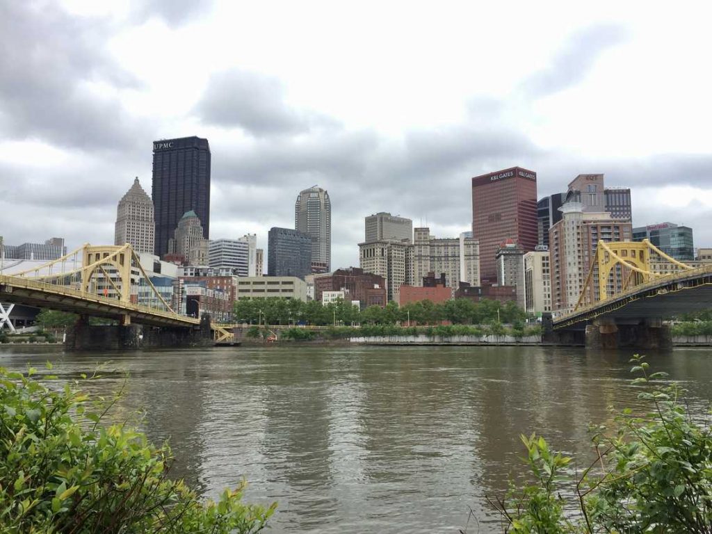
Beginning your trip in the car park at the Millvale end of the Three Rivers Heritage Trail will not give any hint of the stunning views that are ahead. This North Shore Trail offers a wide variety of scenery: you will pass bridges, boat houses, and the riverbank that is covered with leaves, as well as industrial junk. There is a metal footbridge with wheelchair access that will take you to Washington’s Landing and you can wave to kayakers as they float by. As you near the North Side, you will see the “Three Sisters” bridges that cross the Allegheny River and then you can take a walk along the concrete waterfront with a clear view of the city center. The trail leads up to PNC Park, the Carnegie Science Center, Acrisure Stadium and further on. There is easy access for pedestrians to the Fort Pitt Bridge which goes directly to the Golden Triangle.
Distance and Location of the North Shore Trail: 6 miles from Millvale to Chateau
Allegheny River Trail

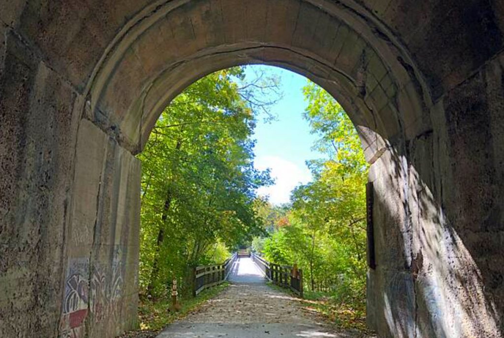
Franklin, which is situated in the hills of Venango County, is a delightful place and definitely deserves a visit. It is also the perfect starting point of The Allegheny River Trail, a surprisingly lengthy route that extends from Franklin to Foxburg in Clarion County. People who traverse this trail will get to witness the grandeur of the mighty Allegheny River as they pass through woodlands and railway tunnels. There are designated picnic spots to take a break, and hardly any buildings or cars are found in the unspoiled area. The most exciting part is, once one completes the path from Foxburg to Franklin, they can go on to the Justus Trail, which will lead them to Oil City, and from there, it is just a short journey to the Oil Creek Trail – the ideal way to explore Pennsylvania’s remarkable Oil Heritage Region.
Distance and Location of the Allegheny River Trail: 32 miles from Franklin to Foxburg
South Side Trail
The Three Rivers Heritage Trail’s South Side Trail runs right alongside East Carson Street and is never far from the area’s most bustling boulevard. However, the trail is nothing like that. It is quiet, tranquil and lined with trees. It begins near Station Square and continues until it reaches Southside Works. At the Birmingham Bridge, one can take a break and observe the ducks, or admire the Monongahela River through the gaps in the trees. The landscape is dotted with industrial relics like Carrie Furnace, as well as bridge piers and big chunks of concrete. It’s possible to spot a train chugging along the still-functioning railroad which follows the trail. The neighborhood is filled with bike shops and businesses that are bicycle-friendly, so cyclists are welcome everywhere they go.
Distance and Location of the South Side Trail: 3 miles along the Southside from Station Square to Southside Works
Oil Creek Trail
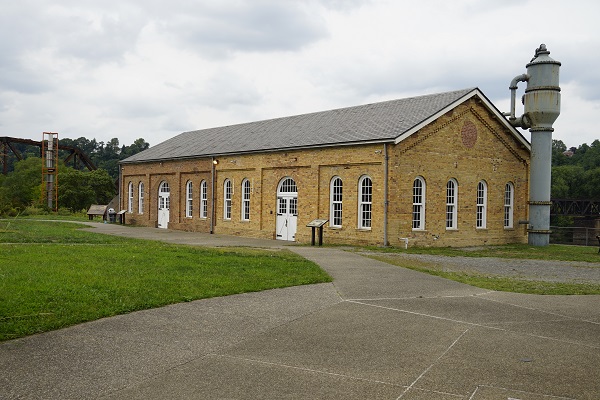
Centuries ago, Oil Creek was the location of a bustling petroleum industry. People from all over flocked to the area to search for “black gold.” This led to an unregulated slum known as “Pithole” being built by the workers. Unscrupulous competition was rife among the workers in order to drill successful wells in the valley. To facilitate their activities, saloons and hotels were built. The community eventually dissipated and the structures that housed it were replaced by a forest, a river, and a walkway in the national park. Venango County offers picturesque trails that the locals take full advantage of. The Drake Well Museum and plaques along the path allow people to get a glimpse of what the area looked like in the 1860s. The 3-mile Queen City Trail extends the route to Titusville from Oil Creek State Park. Numerous footpaths in the forest make the area great for an overnight stay with the Adirondack shelters at the far end of the park.
Distance and Location of the Oil Creek Trail: 9.5 miles in Oil Creek State Park
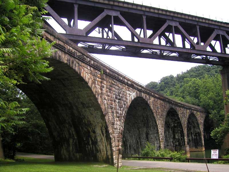
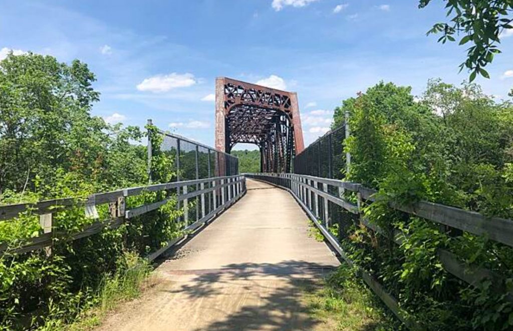
Steel Valley Trail
This section of the Monongahela River used to be one of the most active industrial regions in the U.S. Its factories turned this part of western Pennsylvania into a mess environmentally. The Steel Valley Trail follows the railway line that connected these forges and warehouses, along with crossing railroad tracks and going over hills. It even passes Kennywood Park (you can take a break and watch the roller coasters through the trees). This trail also features some of the most remarkable trestle bridges in the area, so you can explore them. For bicycle riders aiming to ride from Pittsburgh to Washington, D.C., this path was the missing connection between South Side and McKeesport. After many years of negotiations and construction, that long-distance route is now complete.
Distance and Location of the Steel Valley Trail: 19 miles from Southside Works to McKeesport
Montour Trail
The Montour Trail winds its way through the suburbs of Pittsburgh, making it the longest and most varied route in Allegheny County. Starting from Coraopolis, close to the Ohio River, the path stretches across urban developments, fields, forests, trestle bridges and several rivers, before eventually reaching Library in South Park Township and Clairton. Every mile of the journey is unique and offers a different terrain, with some parts of the trail so lightly used that it feels like you have the entire area to yourself. As the Montour Trail passes through such an assortment of landscapes, it is an ideal place to spot wildlife, like birds, deer and more. Additionally, the trail is used regularly for races and bike rides, like the Montour Trail Half-Marathon and Tour the Montour Trail Ride. The only disadvantage of the Montour Trail is that it sometimes needs repairs and maintenance, resulting in sections of the trail being closed.
Distance and Location of the Montour Trail: 45 miles from Coraopolis to South Park Township
West Penn Trail
The Westmoreland Heritage Trail and West Penn Trail have a common point of origin in Saltsburg, and if you have the time, you can traverse both in the same day. The West Penn Trail runs parallel to the meandering Conemaugh River and cuts through Indiana County, from Saltsburg to Blairsville, in a near-straight line. On the route, you will find minimal human habitation, making the West Penn Trail an ideal spot to appreciate the surrounding natural environment. The Conemaugh River, which was once used to maneuver riverboats, offers beautiful views. The Conemaugh Valley Conservancy is particularly proud of the West Penn Trail as it is part of the 320-mile long Pittsburgh-to-Harrisburg Main Line Canal Greenway, a green corridor that links the two cities.
Distance and Location of the West Penn Trail: 17 miles from Saltsburg to Blairsville
Westmoreland Heritage Trail
The Westmoreland Heritage Trail is an intriguing new track, not just because of the spectacular natural scenery, but also since it is a work in progress. In 2013, the Westmoreland Heritage Trail Chapter concluded a 4-mile “Phase II” extension, and now they have since extended it to Trafford, doubling it’s length. People who have never had a reason to visit Westmoreland County will be able to explore the area in a different way. History fanatics will be delighted to observe the industrial artifacts spread throughout the region, and nature fans will find plenty of forests and wildlife. This route is unique from most rail trails because there is a 5-mile incline on the way out of Saltsburg in southern Indiana County, so be prepared to break a sweat. Witness how the latest addition to Pennsylvania’s trail system evolves over the years.
Distance and Location of the Westmoreland Heritage Trail: 9 miles from Saltsburg to Delmont
Great Allegheny Passage
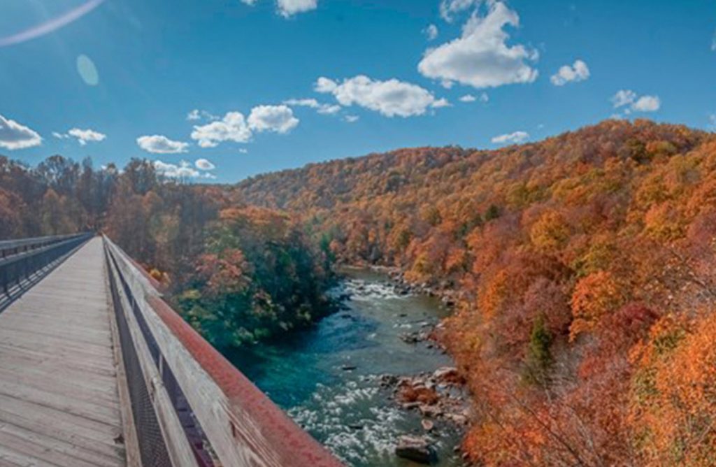
The Great Allegheny Passage is the most renowned of all the rails-to-trails projects, making a name for itself in not just Pennsylvania and Maryland, but through the whole US. For a long time, cyclists wished they could take a single path from Pittsburgh to Washington, D.C., following the old railroad line and then carrying on along the C&O Canal. Currently, individuals can have breakfast in the South Side and ride all the way to Cumberland without having to pass many cars. As you move through Connellsville, Meyersdale and other small towns, you’ll view rugged rivers, flourishing woodland and impressive railroad tunnels. If you schedule some extra days, you can take pleasure in the Ohiopyle State Park, one of the most adventurous outdoor spaces in western Pennsylvania. In case you’re biking from Pittsburgh, the opening half of the Great Allegheny Passage is a gentle uphill ride, however, once you reach the Eastern Continental Divide, the remaining part is a downhill ride to Cumberland.
Distance and Location of the Great Allegheny Passage: 150 miles from Pittsburgh to Cumberland, MD
Eliza Furnace Trail
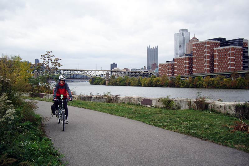
The Eliza Furnace Trail is an integral element of the Three Rivers Heritage Trail plan for the city and it has been given its name due to the old industrial smelting plants that were erected along the Monongahela River. It is also known by many as the Jail Trail as it encircles the Allegheny County Jail. This route goes in a direct line from the Panther Hollow in Oakland to the downtown part of the city, skirting the southern bluffs of Pittsburgh and differentiating from the highways. The sound of cars whizzing past can be heard in particular places, but the terrain is level and even, and lots of cyclists and inline skaters come out when the weather is nice. The trail affords some unique sights of the river, the Birmingham Bridge, and the South Side. There are parking lots on both ends, making it a cinch to load and unload bicycles. When traffic is at a standstill in Uptown and the Hill District, this trail is a great alternative to avoid the jam. The Eliza Furnace Trail is one of Pittsburgh’s oldest and most used pathways.
Distance and Location of the Eliza Furnace Trail: 5.2 miles from Hazelwood to Downtown Pittsburgh
Panhandle Trail
Washington County’s Panhandle Trail is an underrated treasure, stretching from the Montour Trail to the West Virginia border. This picturesque route offers a unique vantage point to admire the rural countryside, featuring streams, farms, and churches. The terrain is rough, so it can be more challenging to bike than on the nearby urban trails. However, hybrid bike tires should be suitable. Autumn is a particularly stunning time to visit, since the annual “Night Walk” typically falls around Halloween. Although there will likely be fewer people on the trail, wildlife is abundant, with opportunities to spot wild turkeys and snapping turtles.
Distance and Location of the Panhandle Trail: 29 miles from Carnegie to Weirton, WV
Coke Trail
Mount Pleasant and Scottdale are exemplary of traditional small towns in Pennsylvania. There are roads with antique brick structures, historical monuments and a long history of farming and production. Between these two towns is the scenic countryside of Westmoreland County and hiking the Coal & Coke Trail is an ideal way to explore it. As the name implies, the Coal & Coke Trail goes through former industrial sites where coal was formerly excavated and refined, even though now you will find tree-lined neighborhoods in the area. Along with meadows and forests, you will also pass plenty of backyards, roads and sports fields. The path is just long enough for a relaxed ride in the afternoon and it passes alongside a beautiful creek and the still-functioning railway. Volunteers of the locality are striving to develop the route, making improvements to the signage and seamlessly connecting the various trial segments.
Distance and Location of the Coke Trail: 6 miles from Mt. Pleasant to Scottdale

